Nearly 130,000 people in central Virginia were told to move indoors immediately on Wednesday afternoon as severe thunderstorms increased the risk of injury to anyone caught outside.
Why It Matters
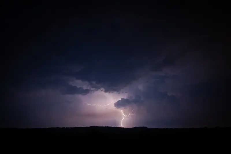
Severe thunderstorms producing 60 mph gusts can snap large tree limbs, topple whole trees, and send unsecured objects airborne, creating hazards for people, vehicles and structures. The severe thunderstorm warning, issued by the NWS Baltimore office warned that such winds could "cause some trees and large branches to fall," potentially injuring those outdoors and blocking roadways, which can impede emergency response and lead to secondary accidents.
The combination of damaging winds and continuous lightning raises immediate safety and infrastructure concerns, including power outages that may affect thousands of customers in a short period.
What To Know
The severe thunderstorm warning was issued for Charlottesville and northeastern Albemarle County on Wednesday afternoon, warning of radar-indicated wind gusts up to 60 mph and urging residents to move indoors immediately. The warning was in effect until 5:15 PM EDT and reported a storm moving southeast at about 20 mph.
The warning highlighted an immediate risk of damaging winds, falling trees and continuous cloud-to-ground lightning that could injure people outdoors, damage property and cause localized power outages. The advisory listed multiple communities in central Virginia as potentially affected and included explicit shelter guidance for public safety.
"Damaging winds will cause some trees and large branches to fall," the warning said. "This could injure those outdoors, as well as damage homes and vehicles. Roadways may become blocked by downed trees. Localized power outages are possible. Unsecured light objects may become projectiles."
The warning, issued at 4:51 PM EDT, covered the City of Charlottesville and northeastern Albemarle County until 5:15 PM EDT. Although the warning has expired as of publication of this article, a hazardous weather outlook across the area warned of scattered storms throughout the evening.
"Scattered showers and thunderstorms are possible this afternoon and evening," a hazardous weather outlook issued by the NWS office in Wakefield, Virginia, said. "Locally heavy rainfall and localized flooding is possible."
A flash flood warning also remained in place in Central Virginia.
What People Are Saying
NWS meteorologist Kyle Pallozzi told Newsweek: "We've got a few storms ongoing. The one in Charlottesville just moved out of our forecast area into Wakefield's area. The most concentrated thunderstorms are near Baltimore, south and east of the city. There's another thunderstorm just south of D.C., but nothing severe is warranted at this time."
NWS Baltimore, in a severe thunderstorm warning: "For your protection move to an interior room on the lowest floor of a building. Damaging winds and continuous cloud to ground lightning are occurring with this storm. Move indoors immediately. Lightning is one of nature's leading killers. Remember, if you can hear thunder, you are close enough to be struck by lightning."
What Happens Next
Although the warning has expired, the threat for severe storms remains throughout the evening. Officials and residents in the warning area were advised to monitor updates from the NWS and local emergency management.
Related Articles
- Meteorologists Reveal Chances of Tropical Storm Erin Impacting US
- Severe Thunderstorm Warning Issued as Flights Across NY, NJ Delayed
- Tennessee Flash Flood Map Shows Which Cities Could Get Hit Hardest
- Millions of Americans Urged to Avoid the Sun in 16 States